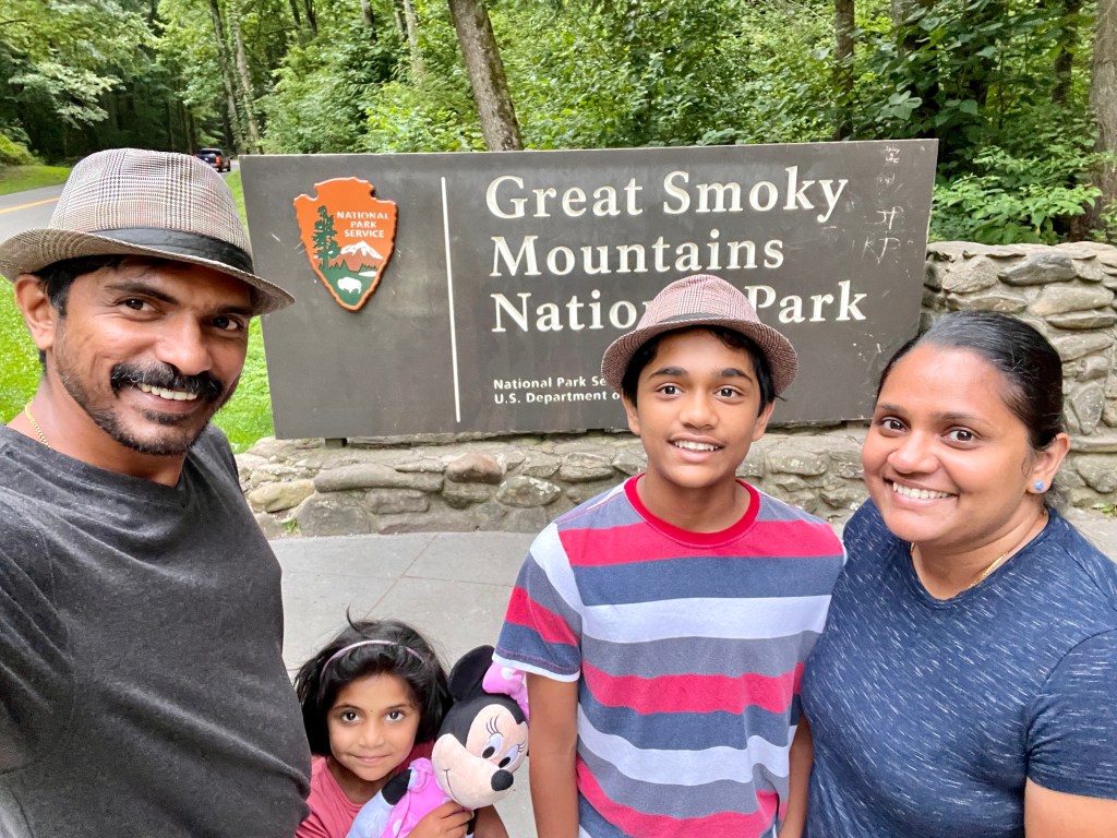
Great Smoky Mountains National Park July 22-27
We started the trip in the afternoon of July 22. We packed a lot of stuff, and the inside of the car was packed, but we were full of energy, ready for the trip ahead. It was like being sardines in a can for the next day and we reached only in the 23 afternoon. But we immediately saw the effects of moving out of Texas. As soon as we were in Arkansas there was greenery and misty fog early in the morning. We won’t see that sight in Texas even if it miraculously rained for a long time. So as we were seeing thick forests beside us, some military vehicles drove right past us, one with something really big covered on the top of the cars window. Those cars were either props for a movie or military base nearby. Soon After we saw those cars, we were passing the Mississippi River A.K.A. the border between Arkansas and Tennessee we also saw the Memphis Pyramid. In the afternoon of that day, we reached our hotel. We had to go through the park in order to get to Gatlinburg, and we saw some more greenery. That was the the major events for day 1 and 2.


|||||||||||||||||||||||||||||||||||||||||||||||||
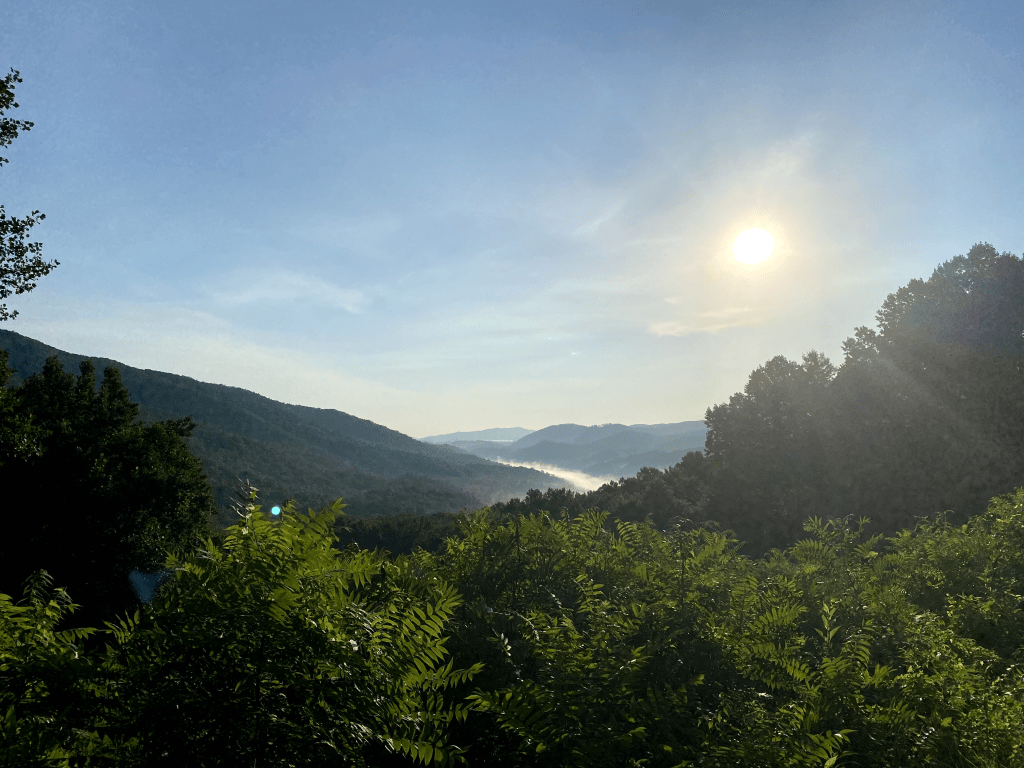
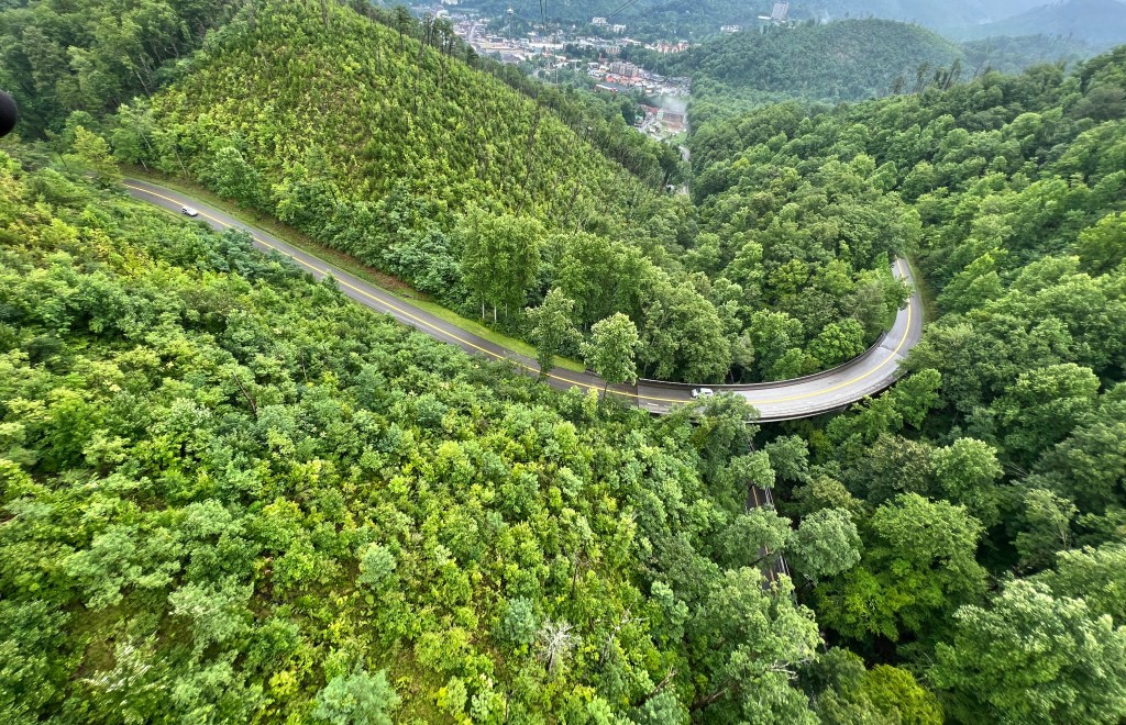
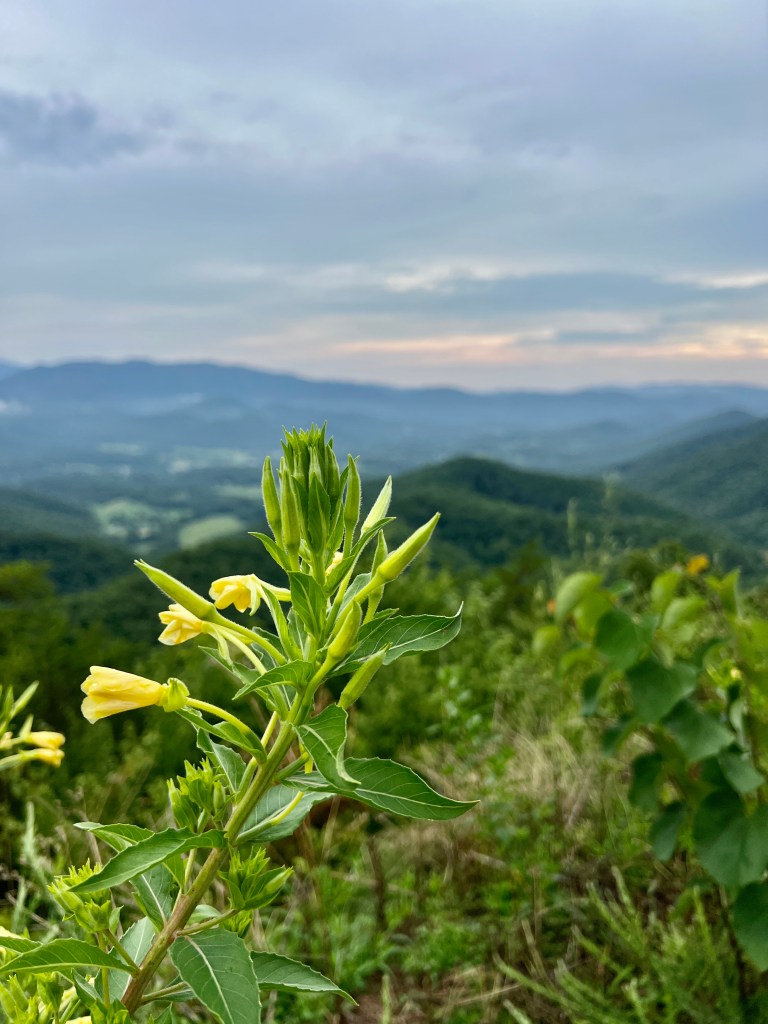
We woke up Way, Way, early in the morning. We were gonna go to the Great Smoky Mountains National park today. And as we started out, it was certainly smoky outside. The “smoke” is actually highly volatile water and hydrocarbons exuded by nearby vegetation. Once you get inside the park, the roads climb elevation really quickly so we had a clear view of the “smoke” climbing up the mountain side.

The entrance to the park is free so any one can get in as long as people obey the rules. After some time we reached Cades Cove. Cades Cove was the first place we were going to in the Great Smoky Mountains National Park. Cades Cove is a place with a lot of history. There are cabins, Churches and other types of buildings made by the European settlers who used to live there and there are evidence of Cherokees Indians traveling through the valley a long time ago.

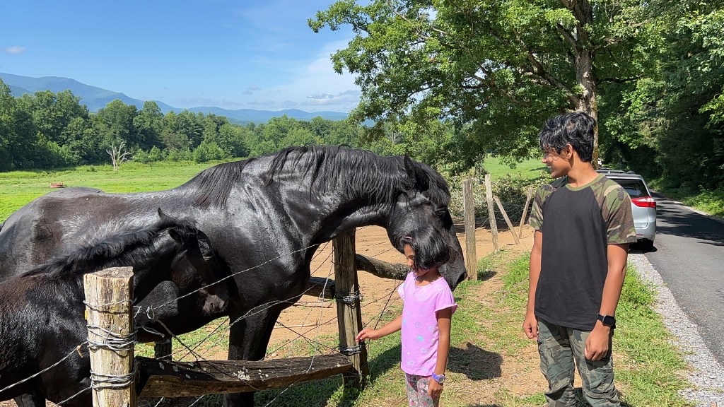
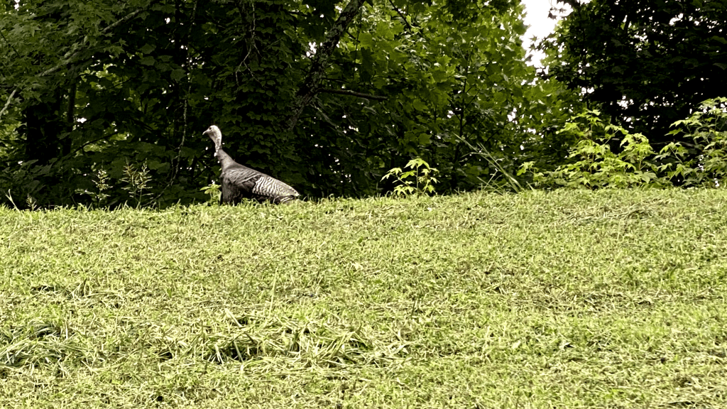
Today, people visit this valley to see how life for the settlers would have been. I learned that when the National Park Service first bought the land, most settlers gave it up willingly, but some settlers lived there on lease till the end of their days. One particular settler even went to court to combat the NPS legally so the settlers could still own the land. He lost. The last Schoolhouse closed in 1944 and the post office closed in 1947. We went inside Cades Cove hoping to see some wildlife but all we saw were some Turkeys, Domesticated Horses (There was a horse-ride ranch in Cades Cove), Deer, and Butterflies. Oh and some Birds. That is definitely not a lot of wildlife. We did not see a bear though. On our first trip through the Cove, we stopped in one of the cabins and ate our Breakfast of Bread and Nutella. We went Early in the morning because we wanted to see wildlife.

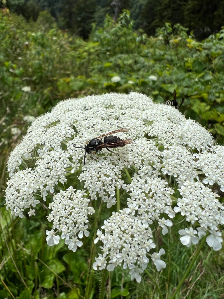
As stated earlier we only saw a little bit of wildlife. So that is why we had to eat breakfast in our car in one of the cabins. Don’t worry, we did not litter. While we were there we checked out the Cabin and there were BEES EVERYWHERE. I don’t know why but there were a lot of them. As we escaped the bees, we saw a lady who was photographing the nearby
bird-life. We talked and saw her TWO more times when we went on the Cades Cove Loop again.
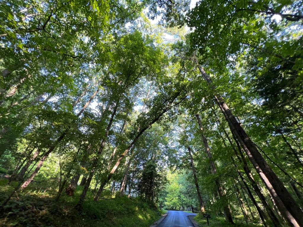
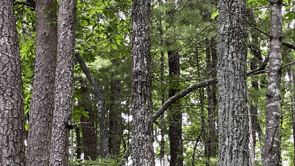
The second time we went on the loop we took a shortcut then we took another shortcut to the end of the loop. Then we went around the loop AGAIN and we climbed the Rich Mountain Road. Rich Mountain Road is a 7 mile winding road that has quiet view of Cades Cove. I say quiet because you can’t hear people talking. We chose this road because of the possibility of seeing bears. We went on this winding road and saw a Cross on a tree. Maybe there was a person buried there? We did not stick around long to find out. The only reason we saw the cross was because we were in a clearing with a view. I just happened to look on the other side.

Next, as we continued on the quiet road, I used the moonroof on the car to stand up. It was like going on a mild rollercoaster. But using that moonroof was a mistake (I’ll tell you guys later). We travelled till the road became downhill. Thats when we saw more turkeys. Not what we hoped but it was something. I thought that we were gonna be the only people on the road. I was wrong. There was a car in front of us and later we passed it. Then as we got to the end of that road, we saw an old person walking some dogs. Rich Mountain Road was awesome, and if you guys visit this park, you guys should go to Rich Mountain Road. After that road, we decided to go to Clingmans Dome. Clingmans Dome is the highest point in the Great Smoky Mountain National Park. At first, I thought the Clingmans Dome was the tower, but later I found out that it was the mountain that was named Clingmans Dome. Before we got there, we took a little detour to the Visitor Center. This Visitor Center had a Museum and a gift shop so we decided to go to both. The Museum had all of the Fauna and Flora of the National Park. (Fauna and Flora means Animals and Plants in Science-speak). My most favorite was the Eastern Hellbender. The Eastern Hellbender is a species of giant Salamander, not the biggest but about your arm-length.
Then the Indigo Bunting, Northern Cardinal, and the huge wood piece showing the age of that tree. I could go on but I feel like I should get moving. If you guessed that it was magnet time in the gift shop, you are correct. After that we saw a donation box asking us where we were from. We put some money in the India slot. To Clingmans Dome, again now.

We reached there after about 30 mins. The mountain is about 6,643 and is the highest point in the park and even the highest in Tennessee. There was a steep trail we had to take in order to get to the top of the mountain, and then the tower. We climbed up that tower and saw Pigeon Forge, Gatlinburg, and 7 states. The last one is just something the internet tells me but I am not sure if its true. Then we began to climb down to the Visitor Center and buy a magnet. We did buy the magnet and I also saw the stamps for the National Park Passports. I didn’t bring mine for the trip. I forgot it. But I stamped one of the papers near it, (took the paper home and taped it to the passport). Then my dad got the idea to buy the passport for my sister. It was not in the Clingmans Dome Visitor Center. So we decided to go to the Visitor Center again to buy the passports. And we did so we stamped the passport at the Visitor Center too.


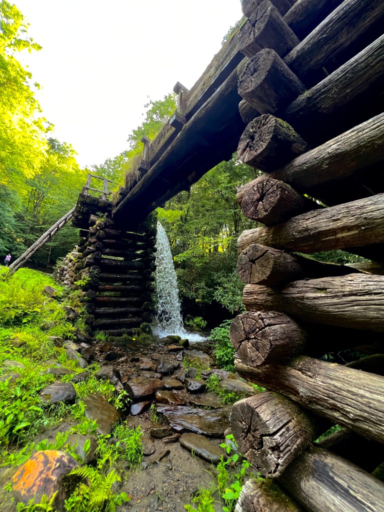
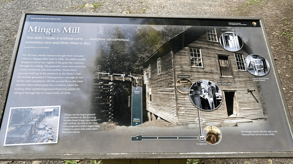
Next Place on the list was the Mingus Mill. The Mingus Mill is how the people of the valley got corn flour and wheat flour. The Mill draws water from the nearby Mingus creek and then it turns an iron turbine underneath the Mill which then grinds the wheat or corn into flour. Its actually cool to imagine, but we did not get to see the inside of the Mill because we were too late. The Mill was closed by the time we reached it. After the Mill, we decided to go to Blue-Ridge Parkway.


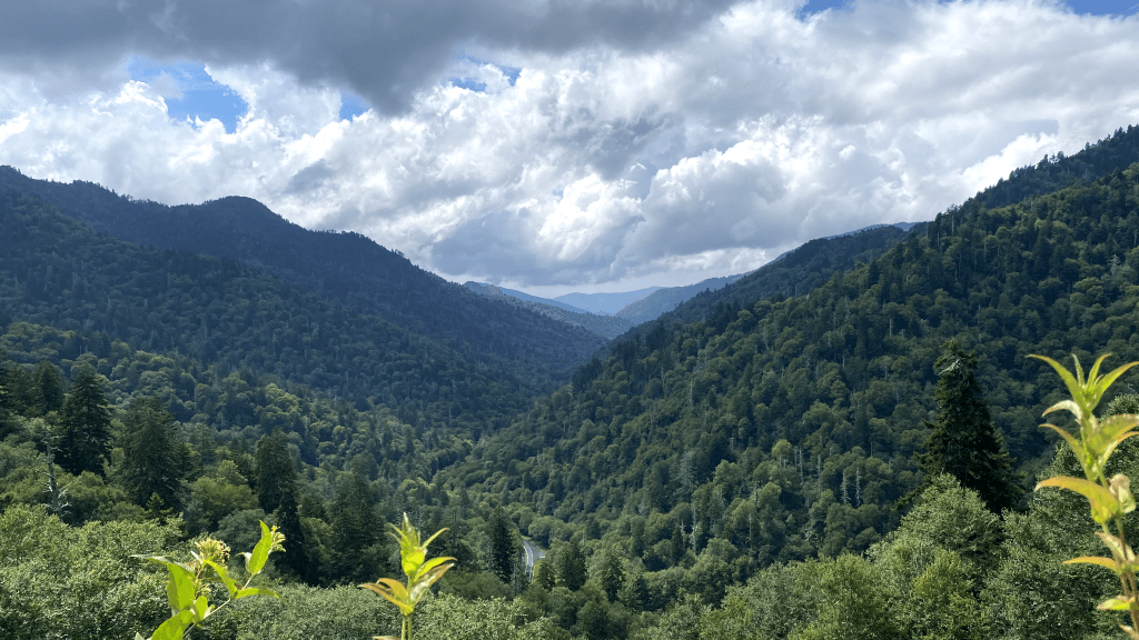
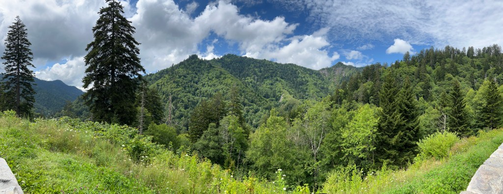
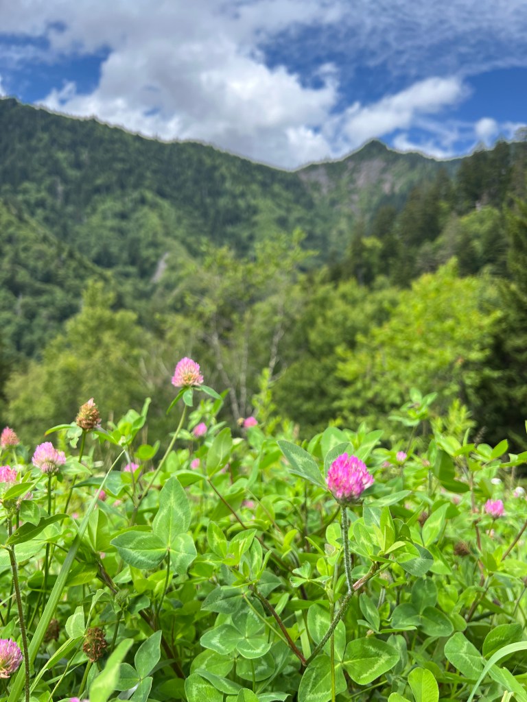
The Blue-Ridge Parkway is named “Blue” because of the mountains that it goes through. The Fog makes the mountains look blue. The Blue-Ridge Parkway is a place where you can drive to see the scenery and you can sometimes stay there to catch the sunset. That was what we were going to do that day. But before we entered the Blue-Ridge Parkway we saw some Elk being posing for us near another Visitor Center. Of Course we stopped to take their photos. But after that we continued with the Blue-Ridge Parkway and saw some spectacular scenery. Afterwards we stopped at one of the places to catch the sunset. Once the sun went down we went to the hotel to rest and sleep for another big day in the Smokies. But just as we entered the park, we saw the elk again and then we saw a fox jumping past us in the road. No photos of the fox because it was too fast.


|||||||||||||||||||||||||||||||||||||||||||||||||
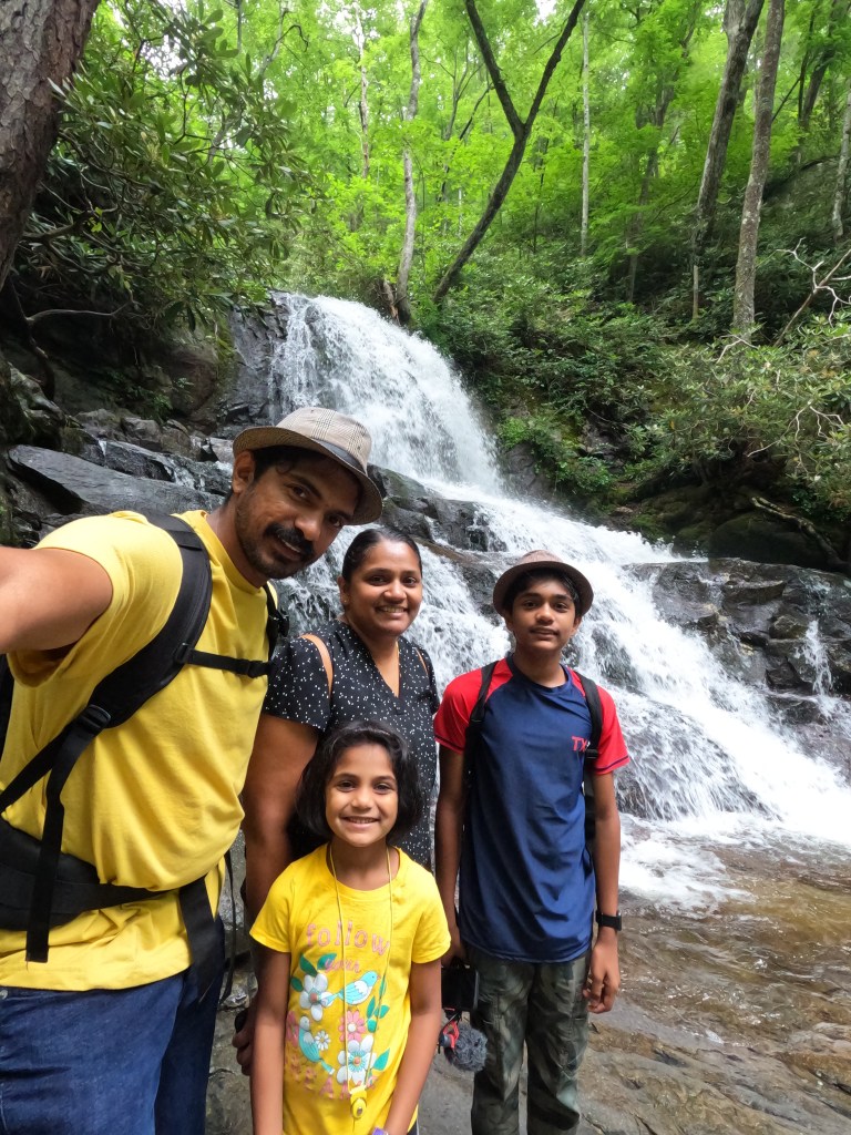
The next morning we woke up early, like always, and we went to Laurel Falls. Though we woke up early, it took us a long time to get ready. And I got sick. (If you guessed it was because of the moonroof use, then you are correct). All these reason caused us to come to Laurel Falls when all the parking spots were gone. And we could not just park on the side of the road because the Park Rangers would not let us. Luckily, after sometime, the people who got here first showed up and gave us their parking. After that we got ready and started walking. A roundtrip length of this trail is 2.6 miles, so 1.3 miles each direction. Most of the path was smoothly paved but as we got to the end it was cracked. We saw more mushrooms in this trail than any trail we had ever taken. It got a lot steeper as we reached the falls. Laurel Falls is 80 ft tall and consist of an upper and a lower sections. We only saw the upper section; the lower section was underneath us and it was too steep to climb down to. We only stayed there for a little bit but we got a lot of pictures of the waterfall. As we climbed back I noticed something we didn’t see last time.


It was a box that counted how many people walked on that trail that day. My dad took a bit of videos that day on that part of the trail so we may have confused the scanner. After the trail, we saw people waiting for other people to come from the trail, just like we were waiting when we got to the parking. We made way for them and then got out of the Great Smoky Mountains National Park into our hotel. But it rained so we stayed in our car at first and then we came out only after the rain was gone. After we got into the hotel my family and I decided to take the tram (Ober Gatlinburg) (nope its not Uber Gatlinburg). Once we got there, the people who sold the tickets gave us green wristbands. Then we got to the Tram. The Tram takes about 9 minutes to complete and on our way to the top, we almost saw a bear but then it was gone. All I saw was a garbage can spilled on the road. I think the Bear did that. When we got to the top-most point, we saw something cool. The fog had reached the edge of Gatlinburg. The Fog meaning the “Smoky” part of the Great Smoky Mountains National Park. It was only a little bit but if another mountain covered that up, (so it did not look like just a little bit), then it would look like the fog would soon cover the whole town.


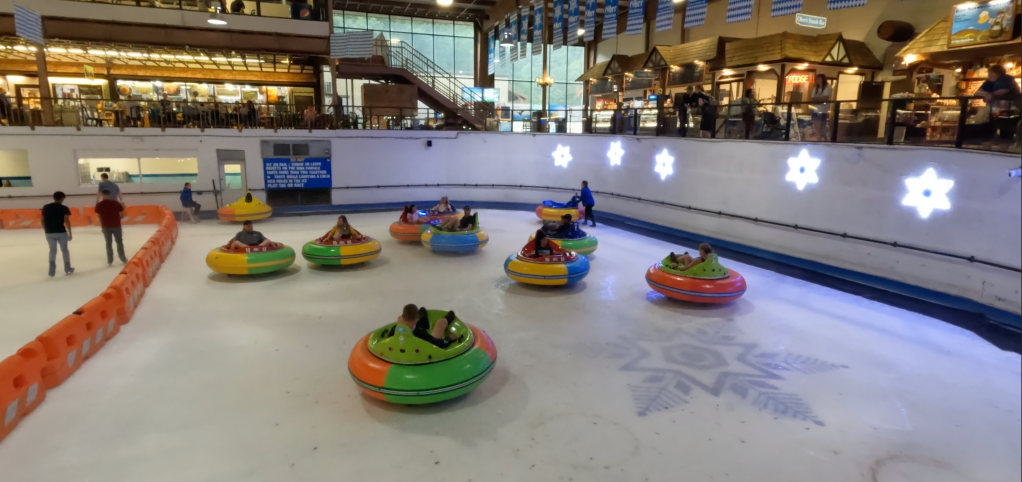
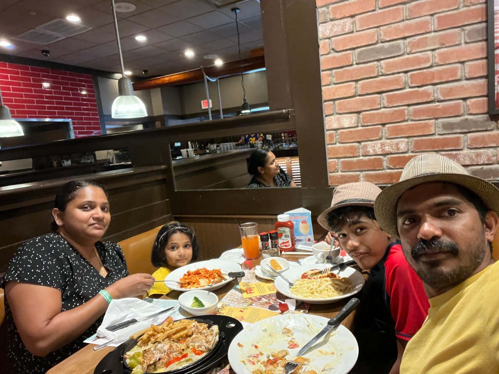
Once we got to our destination we saw a building with Carousels, Ice-Bumper Cars, Ice Skating Area, and places to eat. All this highlighted that this was a money grabbing setup. Even though it was a money grabbing setup, we went into some of the rides. My sister went in the carousel even though she was afraid, and after she was done with the Carousel, all of us went into the Ice-Bumper Cars and we drove it around crashing into each other. But the bad thing was that the line was too long for the Ice-Bumper Cars. We did not go to the Ice Skating Area. It was a big risk for me to even be in the Ice-Bumper Cars as it would be cold and I was sick. But it was fun so I didn’t complain much. After that we were hungry so we decided to go eat. But the food at the places to eat on Ober Gatlinburg was not anything we were interested in. So we decided to go back to the real Gatlinburg and eat where ever we could find. As soon as we got of at the Tram mall, we went left and immediately saw a lot of restaurants. We decided to go to TGI Friday, though I have know Idea what TGI means.


We were full by the time we got out of that restaurant and then we went back to the hotel. On our way we saw some Minions with blue caps. Our plan for the rest of the day was to go to Foothill Pathway (it can also be called Foothill Parkway). We were going to go home the next day, and we did not want to miss on the most important things. After a little bit of rest, we embarked on that journey. Foothill Pathway is the only Parkway to be completed out of the seven Congressionally Mandated Parkways. So this meant we only drove to a small, completed, section of the pathway. We had to pass through the park to get to the Foothill Pathway and it was lucky we did because thats when we saw the fog. Some of the Fog was over hanging over the river like it would be in a creepy swamp. I think this fog is normal fog and not the highly volatile hydrocarbon from the vegetation nearby. I think this because of the rain that happened earlier. We stopped and then went down to the river side to take the photos. As we got closer, some of the fog disappeared, so we figured that the fog wasn’t thick.


There were butterflies nearby flying around and then later a crane came to about ten feet from where we were taking photos from. I guess there were a lot of fish that we didn’t see. As we were getting out to go to Foothill Pathway once more, a SPIDER LANDED ON ME. It was HUGE with LONG, SPINDLEY, LEGS. I didn’t scream and I showed so much restraint at that, that I should get a reward. As the spider ran away, my dad showed me that some people left so bottles to cool on the ground. I thought we should tell a park ranger but we would never get a chance. After a long time, we reached Foothill Pathway. Foothill pathway is a little like Blue-Ridge Parkway too. I think Foothill Pathway is just as good as Blue-Ridge Parkway. We saw a lot of spectacular views, lots of tunnels, and Fog. There was so much fog. Not on the road, but beside us. We went to the hotel early and I thought all the excitement was done. Some of the road was closed off; thats why we went to the hotel early. But as we got there my dad realized we were just in time to go to one more roundtrip to Ober Gatlinburg, at least based on the info that the staff there gave us. So we all ran as fast as we could to get to the Ober Gatlinburg place but we found out that we were too late. The info the staff gave us meant that the last trip ended by the time we got there. We thought the trip began by the time we got there. So that was that and we had to go to the hotel. We slept soon for the long trip back home.


|||||||||||||||||||||||||||||||||||||||||||||||||
We went home through a route to Georgia. We wanted to go to a friends house there. Remember the friends from Atlanta. Well they moved a bit north. After that we had two more houses to go to. Both were in Texas. As we slowly transitioned to Texas, the land became more drier and less greenery was present. Then we reached another friends house. We didn’t stay for long and then we went home. By then it had already taken two days. As we got into our house, we collapsed.
Until Next Time…………………………………………………………………………………….
